Kanha Tiger Reserve
General Info Kanha Tiger Reserve
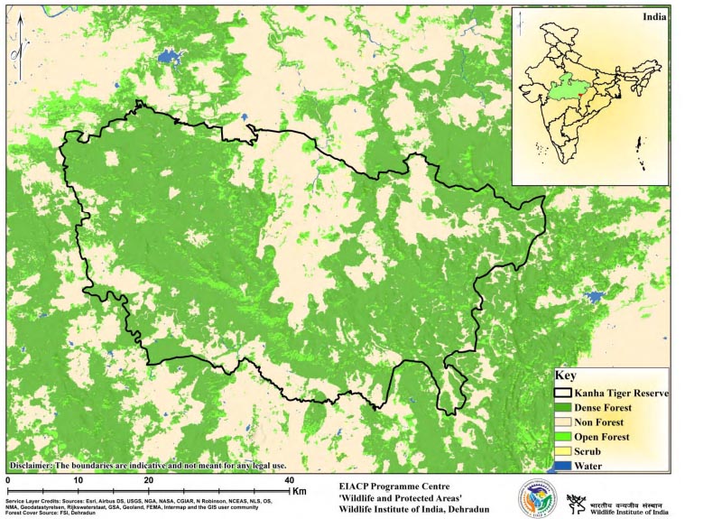
Situated in the Maikal hills of Satpura Range and lies in the Deccan peninsula- Central Highland zone 6E of the Biogeographic classification of India (Rodgers & Panwar, 1988). Kanha National Park was notified in 1955 and falls into two revenue districts: Mandla and Balaghat. A buffer zone of 1134.36 Sq.km. Surrounding the core area of 917.43 Sq.km is treated as a multiple-use area. The buffer zone comprises almost 40 percent of the forest area, and the rest is constituted by revenue and private land. This zone is characterized by an interspersion of revenue and forest lands dotted with numerous villages. The Reserve is an excellent combination of the Dadars (flat hilltops), grassy expanses, dense forests, and riverine forests. Kanha has long been considered an essential tiger reserve for long-term conservation (Wikramanayake et al., 1998; Jhala et al., 2008). Kanha Tiger Reserve is one of the most well-known wildlife protected areas, and it has had significant success in providing a safe refuge for the diverse floral and faunal assemblages thanks to the collaborative efforts of Project Tiger. Besides harboring a viable state population of the tiger, Kanha has distinguished itself in saving the endangered hard ground Barasingha from extinction and supporting the last state population of this deer species. The vegetation of Kanha Tiger Reserve falls under two types (Champion & Seth, 1968): moist sal forests (3C/C2), with subgroups high-level sal (3C/C2 ci) and low-level sal (3C/C2 cii), and miscellaneous forests (3A/C2), with subgroups southern tropical moist deciduous forest, southern tropical dry mixed deciduous forest, and grassland.
Description
State : Madhya Pradesh
District : Mandla and Balaghat
Coordinates : 22° 1' 5" N, 80° 26' 10"E
Area : 2051.79 Sq.km.
TR Notification year : 1973-1974
Tiger Population : 88 (All India Tiger Esitmation, 2018)