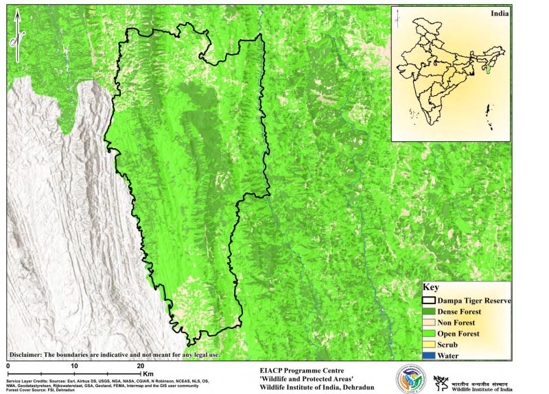
Dampa Tiger Reserve
General Info Dampa Tiger Reserve
Dampa is located on the international border with Bangladesh in the western portion of Mizoram State. The Reserve is composed of moist deciduous forests in the lower levels and evergreen and semi-evergreen forests with natural grassland at higher elevations. The protected region is comprised of undulating high and medium hills extending north to south, with very high cliffs and inaccessible slopes in the middle. Deep valleys with broad flat terrain along the river, particularly Keisalam, Seling, and Aivapui, compose the area's lower reaches, which eventually drain into the river Khawthlangtuipui. A Chieftain ruled Dampa until 1950, and the primary land use in the lower sections was Jhum (shifting) farming. Small hamlets began to form in the area in the early 1960s for extensive shifting farming in the lower reaches. This had a negative impact on the area's biodiversity. Dampa was named a Wildlife Sanctuary in 1974 and re-notified in 1985 to safeguard the rapidly diminishing natural asset. During the District Council time in 1952, the riverine region to the east and west along the Khawthlangtuipui (also known as the Sazalui or the Tui-lianpui river to the west and the Teirei river to the east) was proclaimed as Reserved Forest. The Reserve's principal forest types include tropical evergreen and semi-evergreen forests, tropical moist deciduous forests, and submontane forests.
Description
State : Mizoram
District : Mamit
Coordinates : 23°20’55” N, 92°16’08” E
Area : 988.00 Sq.km.
TR Notification year : 1994-1995
Tiger Population :Nil (All India Tiger Esitmation, 2018)