Namdapha Tiger Reserve
General Info Namdapha Tiger Reserve
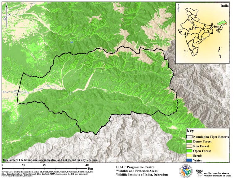
Namdapha Tiger Reserve is named after the river Namdapha originating from Daphabum, the highest mountain peak in the Reserve. Almost the protected area has dense vegetation covered with high hills, rivers, and seasonal streams. The area was initially established as a Reserved Forest and was declared a Wildlife Sanctuary in 1972 and later as a National Park in 1983. More than 60 percent of the area of the Protected Area is remote. The bottlenecks and remoteness of the large part of the Reserve act as a natural barrier to its protection, but at the same time, handicaps the management activities. The area of the Reserve is delineated on the north, south, and southeast by the international boundary between Myanmar and India. On the northern and western sides, the Reserve is surrounded by the contiguous habitat of the Kamlang Wildlife Division and Namsai / Nampong Forest Divisions. Thus, the corridors surrounding Namdapha can be categorized as (1) Reserved Forests, (2) Unclassed State Forests, and (3) International Boundaries. Due to the contiguity of the forest boundaries, there are distinct corridor linkages for elephants, tigers, and other mammals. Assam Valley Tropical Wet Evergreen Forest, Upper Assam Valley Tropical Wet Evergreen, Assam Valley Tropical Semi Evergreen Forests, Sub Himalayan Light Alluvium Semi Evergreen Forests, Secondary Moist Bamboo, Eastern Hollock Forest, East Himalayan Moist Temperate Forest, and Moist Alpine Scrub are the major forest types found in the Reserve.
Description
State : Arunachal Pradesh
District : Changlang
Coordinates :27.4455° N, 96.5358° E
Area : 2052.82 Sq.km.
TR Notification year : 1982- 1983
Tiger Population : 11 (All India Tiger Esitmation, 2018)